Wednesday, September 12, 2012

Petra

Walking through the Suq.
The treasury appears through the cracks at the end of the Suq.
The treasury as seen during mid-day.  It's so hot that even the camel can't take it.
One of the several tombs located off the beaten track in Petra.
The Great Temple, which is the largest free standing building in Petra.
The monastery, located at the very top and end of Petra.
Doing my Usain Bolt impression inside the monastery.


Jordan has several tourist destinations, but they all pale in comparison to the oft-photographed, oft-Indiana Jones referenced Petra.
                This massive site sits in the southwest area of the Jordanian desert – great in the winter time but can be brutal to take a stroll in mid-summer.  Some people even recommend taking three days to walk through this ancient capital, but a majority can be seen in one long day. 
                Petra became the city we know today during the 3rd century BC, but was eventually swallowed up via the Roman Empire until it was largely abandoned from an earthquake in the 5th century AD.  During the high point of Petra’s existence, people came from all over the Middle East and the Arabian Peninsula to conduct business in the trade capital.  Taxes, trade, slaves, nomads, and new technologies all made their way through this town during its glory days. 
                The site begins with a walk through the one mile suq.  The suq is a long narrow walkway protected by 50 foot high walls and rock hewn water channels that lead to the center of Petra.  The suq finishes to a dramatic view of the famous treasury, which is known from Indiana Jones entering this ancient site to retrieve the chalice in “Indiana Jones and the Last Crusade.”  From the treasury the site splits into several different ancient sections.  Perched high at the end of the ancient grounds is the monastery.   Tombs, theatres, and altars line the city from the end of the suq to the monastery.
                I traveled to Petra during the hottest part of the year during Ramadan.  Pictures are best obtained during dusk when shadows are less prevalent on the ruins.  Trips to the ruins cost $70, but will run you $110 if you are doing a day trip from Israel or Egypt. 

Sunday, August 12, 2012

Top Ten of Africa

              On my journey across Africa I’ve been to fifteen countries and stayed in fifty different places.  The continent has every type of environment, activity, and cost you could imagine.  It has the most expensive hotels in the world, backpacker haunts with activities, and transient places to gets you a place to sleep for the night before moving on to the next spot.  I thought I would share my favorite places along this continent.   There are no expensive hotels on the list; rather these are backpacker spots that are no more expensive than $45 per night.  Without further ado, here are my ten best places to stay in Africa:

10.       Gecko Lounge - Cape Maclear, Malawi

               This is the definition of a lounge.  It sits on the sandy shores of southern Lake Malawi with the goal of providing clients with a place to lie around and relax.  The views are great and there’s a good backpacker vibe in Cape Maclear.


The lounging possibilities here are endless.  Gecko's at Cape Maclear.

9.  Mozambique Island, Mozambique

          OK, it’s a major pain to get here.  But once you’re here, you’ll want to stay.  Rooftop bars and restaurants line the stone town section of the island.  The cool breeze will help you with the hot and humid temperatures.  Plus you can rent bikes to ride around the island, and tour the oldest European built building in the southern hemisphere. 

You can find a nice sunset here almost any night.  Mozambique Island.

The bike rides around the island will make you privy to some interesting sites.  Mozambique Island.

8.  Lamu, Kenya

               It’s considered the bastard stepchild of Zanzibar’s Stone Town, but it is a place unto itself.  Donkey rides are abundant, the beach is great, and you can spend hours winding around the alleyways.  You’ll find friendly people and places with crazy staircases leading you to better views of this beautiful small town. 

More alleways than you have time to explore.  Lamu.

7.  Byoona Amagara – Lake Bunyonyi, Uganda

           There’s nothing much going on here, and that’s the point.  One of the most relaxing places you’ll ever stay.  There are canoes to rent, a rope swing, and a simple lounge that overlooks one of the most beautiful places in the world.  Of course, the geodomes are an attraction in themselves. 

The geodomes and balconies make for days spent staring at the lake.  Lake Bunyonyi.

6.  Coffee Shack - Coffee Bay, South Africa

             It’s a bit out of the way from the main tourist road, but the extra drive is well worth it.  The hostel is very simple; there are very few areas that are covered from the elements.  However, why would you want to be inside when you have some of the best coastline in the world and amazing surfing in a gorgeous bay?  A free drink is included at orientation. 

The coastline is unrivaled, and the surfing is too.  Coffee Bay.

5.  Adrift Explorers – Jinja, Uganda

             The rooms are nice and Jinja is cool, but that isn’t the reason you come here.  The star attraction of this place is the bar that sits on a cliff overlooking the Nile River.  It has a great relaxing vibe, and you can watch people bungee jump from the comfort of your seat while drinking.  A free night is included if you whitewater raft with Adrift. 

You can see people jump from the comfort of your bar stool.  Jinja.

4.  Swakopmund, Namibia

             The places are simple.  You don’t come to Swakopmund to lounge at the hostel; you come to play in the desert.   Four wheel biking and sand surfing highlight this highlight of the desert.  Its vast sand dunes are allowed for playing in and on, which makes it one of the most unique places in the world.  

Endless sand dunes, and with it a chance to explore.  Swakopmund.

3.  Flat Dogs Camp – South Luanga National Park, Zambia

              Beautiful national park?  Check.  Great staff and service?  Check.  Elephants waking you up in the morning at your tent?  Check plus.  This place is wonderful, with amazing views and animals that roam through the camp and require an escort when going to and from the restaurant.  Just watch out for the monkeys stealing your breakfast.
 
The camp sits on the Luanga River, which gives it a better than average chance of seeing animals from your tent.  South Luanga National Park.
Or sometimes, the animals just walk through where you are eating.  South Luanga National Park.

2.  Penguin Camp – Dahab, Egypt

            If you are a diver, then this is your Mecca.  Oh, and you can see Saudi Arabia from the lounge.  It’s cheap and friendly, plus you can smoke hookah all day every day here.  The diving is at your doorstep, with a great boardwalk that has an endless amount of restaurants and shops.  You can also explore the Sinai with four wheel drives and camel rides in the desert plus the much coveted hike of Mount Sinai.


A sunrise view of the Red Sea, with the Saudi Arabian hills as a perfect backdrop.  Dahab.
The coastline of Dahab, which is full of hotels, restaurants, and hookah.   Dahab.

1.  Amphitheatre Hostel – Drakensberg Mountains, South Africa

            Once in a while you go to a place that transcends the experience.  Forget the hot tub at the bar, the great nightly communal dinners, and the brilliant rooms.  This place has spectacular views of the Drakensberg Mountains, South Africa’s answer to the beauty of the Grand Canyon.  The hostel has fishing, biking, riding, and amazing trips to Lesotho and the Drakensberg range.  You won’t be disappointed.

One of the many views during the hike of the Drakensbergs.  Drakensberg Mountains.

The Amphitheatre section is a sight to behold.  Drakensberg Mountains.

Monday, August 6, 2012

Luxor

One of the obelisks lit up during the sound and light show at the Temples of Karnak.
The sphinx lined path that brings visitors to the entrance of the Temples of Karnak.
The amazing columns at the Great Hypostyle Hall, the premier section of the Temples of Karnak.
The Temple of Hatshepsut's entrance built next to the side of a mountain on the west bank of Luxor.  The Valley of the Kings is located behind this rock mountain.
Amenhotep III's only visage to the past, the Colossi of Memnon on the west bank.
The kings represented in the main court of Luxor Temple.

                The Great Pyramids are the iconic image of Egypt, but the main sites and history of Egypt are not located in Giza and Cairo.  If you want to learn about Pharonic history then head to southern Egypt, and there is no better place in southern Egypt than Luxor.
                During the era of the Old Kingdom (2700 BC to 2200 BC), the capital of the pharaohs was located in Memphis, near modern day Cairo.  This era was responsible for the beginning of the complex civilization that we would associate with the ancient Egyptians, such as Saqqara and the Great Pyramids of Giza.  All of these sites are located within a close proximity and can easily be visited as a day trip from Cairo.
As times changed, so did the dynasties.  The Intermediate Period (2200 BC to 1550 BC) would see the capital transferred to Thebes, which is located in the current city of Luxor some 450 miles south of Cairo.  It’s during this period, the period of the Theban Kings, which we are awarded some of the best ruins in the world.  Tombs, altars, obelisks, hieroglyphs, and temples are located throughout the area and would take nearly a week to see all the sites. 
The sites of Luxor are broken into two areas: the East Bank and the West Bank of the Nile River.  The East Bank has two marquee sites: Luxor Temple and the Temple of Karnak.  Both are spectacular sites, but the Temple of Karnak has a nightly sound and light show that highlights the ancient ruins.  Furthermore, the Great Hypostyle Hall in the Temple of Karnak is one of the most impressive ruins ever constructed. 
West Bank sites are numerous and much more spread out.  Getting around requires a vehicle, especially in the summer where temperatures can approach 120° F.  The most famous sites here are the Valley of the Kings (a massive area of tombs built into the mountainside, including King Tut’s famously discovered site) and the Funerary Temple of Hatshepsut.  While there are other very worthy sites to visit (Medinat Habu, Valley of the Queens), these are not as popular as the sites listed above.
Due to a hiccup in the train schedule, I was only awarded one full day of visiting Luxor.  I made the most of it, traveling to five different sites in temperatures over 110° F.   Unfortunately, photos are not permitted in or outside the Valley of the Kings, but the rest of the visit was captured. 

Wednesday, August 1, 2012

The historic circuit of Ethiopia

The top of St. George's Church in Lalibela.
Inside Bet Medhane Alem Church in Lalibela.
Standing outside one of the side doors in Bet Medhane Alem Church in Lalibela.
The iconic picture of St. George's Church in Lalibela.
The Rome Stele, the largest stele ever to be raised, in the northern stelae field in Axum.
A chapel in St. Mary of Zion Church in Axum.  This chapel contains the famous Ark of the Covenant, but only priests are allowed inside.
King Fasilides's Castle in Gonder.
The interior of King Fasilides's library in Gonder.
The beautiful paintings inside Kebran Gabriel monastery in Lake Tana.
The common exterior to many of the monasteries, this one of Kebran Gabriel monastery on an island in Lake Tana.

                Ethiopia is a country apart in Africa.  It’s the only country to have their own script (Amharic), a unique food, and a country known for its history rather than its animals.  That is why people come to visit the great ruins of Ethiopia, known as the northern historical circuit.
                While Addis Ababa is the current capital of Ethiopia, this land has been commanded from several different locations throughout the past 2000 years.  The first main capital was located in Axum, where strong ties to trade routes of the ocean along the coast of Eritrea made it a regional powerhouse.  Axum’s light shined the brightest around 300 AD, and during this time Christians from Lebanon and Syria made the pilgrimage to Ethiopia to spread the word of Christianity.  Since that time Orthodox Christianity has been the dominant religion of Ethiopia, no small feat considering the fact that Ethiopia is nearly surrounded by regions with a majority Muslim population. 
                Axum’s decline was inevitable due to scarcer resources in the region, trading competition, and environmental factors.  This led to the capital moving south to Lalibela in the 12th and 13th centuries.  This period resulted in some of the best churches ever built.  Constructed out of the volcanic rock in the ground, these churches literally were carved out complete with vaulted ceilings and floor plans.  Churches range from free standing to partially supported by walls to fully built into the walls.  The most impressive of these churches is St. George church, one of the many free standing churches in the area.
                The capital was once again moved, this time to the west near the Sudanese border of Gonder.  The fertile area made this the prime administrative area for the 17th and 18th centuries in Ethiopia.  Palaces and churches are reminiscent of Camelot’s style in the main area known as the Great Enclosure.  What the British in World War II, and before them the Sudanese Dervishes, didn’t destroy remains here in a highly condensed area of ruins.
                Along the northern historic circuit is the town of Bahir Dar.  This town lies four hours south of Gonder and gives prime access to the old monasteries in Lake Tana built in the 18th and 19th centuries.  These monasteries lie on the banks of the lake, but many are located on islands on this massive lake that is the source of the Blue Nile. 
                This trip can be taxing if taken by bus alone.  Covering more than 1,500 miles alone on this route, I recommend taking a couple flights (some are as cheap as $45) to make it easier on you.  However, no matter how you go, this trip will take you at least ten days to accomplish all the main stops on the route.

Friday, July 13, 2012

Kenyan coast

One of the many corridors in Lamu.
Hanging out on one of the main streets and tourist sections of Lamu.
One of the many beautiful doors in Lamu.  Similar doors are seen in Stone Town, Zanzibar.
Shela Beach, located 5 km from Lamu.
One of the trees that grew around an ancient wall in Gede. 
Kat poses in the mihrab (echo chamber) in one of the mosques in Gede  A mihrab is a section of the mosque where Muslims pray loudly and hear their prayers echo throughout the area
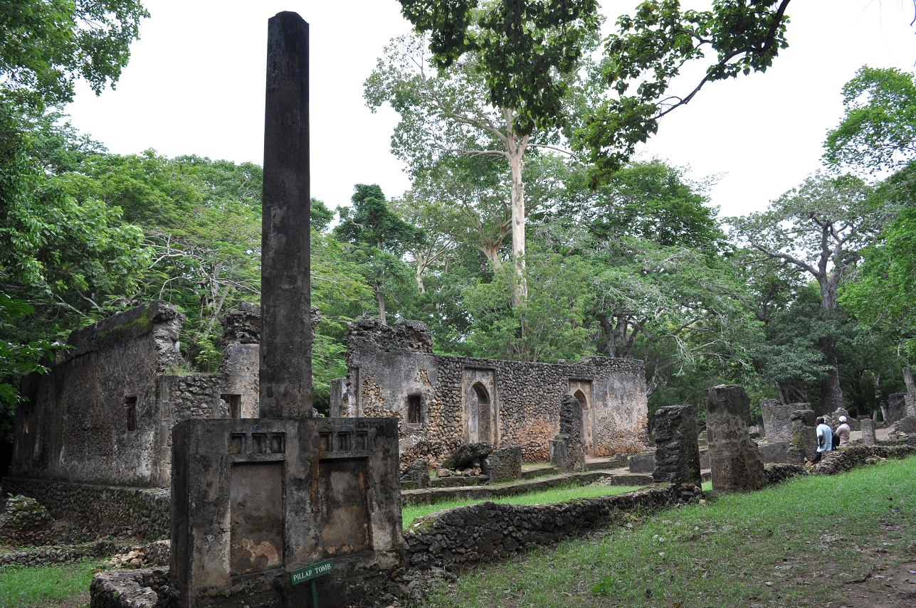
The pillar tomb and Great Mosque of Gede. 
The greater palace area of Gede.  In the foreground is another tree that grew around a palace wall. 

           It shouldn’t come as a surprise that one of Kenya’s major sources of revenue comes from tourism.  Many think of the many safaris (Tsavo, Massai Mara) and Nairobi when discussing tourism in Kenya.  However, the Kenyan coast does a fair share of tourism too.  The beaches and ancient Muslim towns draw tourists every year to the coastal towns and resorts. 
            The 2007-2008 election devastated the tourism in Kenya due to the major violence and fear of civil war.  While those fears were abated and tourism came back, recent issues with Al-Shabaab and Somali refugees have placed major concerns with the Kenya-Somali border and the Kenyan coast.  Terrorist attacks on coastal towns destroyed tourism in Lamu and Pate last year, and recent attacks in Mombasa have reignited concerns about safety on the coast. 
            One of the major tourism sections is the town of Lamu, situated on the northern section of Kenya’s coast.  This old Muslim town is less famous than Zanzibar’s Stone Town, yet Lamu is as beautiful and has just as many winding corridors and fun alcoves to discover.  There are boys riding donkeys through the town and mosques on every corner.  While Lamu may be 100 years past its peak (due to the abolition of slavery, Lamu was once a major slave trading port), it was rediscovered in the past 30 years as a vacation spot.  Shela beach is a popular spot near the town to relax, while Lamu attracts the explorers and adventurers of Kenya.
            Closer to Mombasa is the traditionally Italian and British vacation spot of Malindi.  This beach town is a major commerce center for Kenyans, but Europeans know it for the Italian restaurants and resorts.  A smaller version of Malindi is situated 20 miles south in the beach town of Watamu.  While Watamu may claim tourists for relaxing, it is also next to the famous Gede ruins.
            Gede was once a prosperous town that traded with areas far away as Persia, China, and Portugal.  Due to ivory (and probably slaves), Gede’s trade resulted in a civilization complete with a sultan and several mosques.  There are cemeteries, massive drinking water wells, and communal areas for men and women.  At Gede’s height (estimated between the 12th and 18th centuries), Gede was one of the most prosperous and richest areas on Africa’s Indian Ocean coastline. 
            Gede’s decline is a mystery and has several theories: drawdown or salt water in the wells, disease, attacks from inland, or a lack of continuous resources from the surrounding area.  Whatever the reason is a mystery to the greater mystery of Gede: no one knows much about Gede because there are no historical records or texts of its existence.  There are only conclusions that can be drawn from scientific discovery of the area.
            I spent 10 days on the Kenyan coast this past July.  The Kenyans in this area are very amiable and helpful, some of the best I’ve encountered in Africa.  The only downside to this area is the heat and high level of humidity.  Enjoy the photos. 

Wednesday, July 11, 2012

Mt. Kilimanjaro

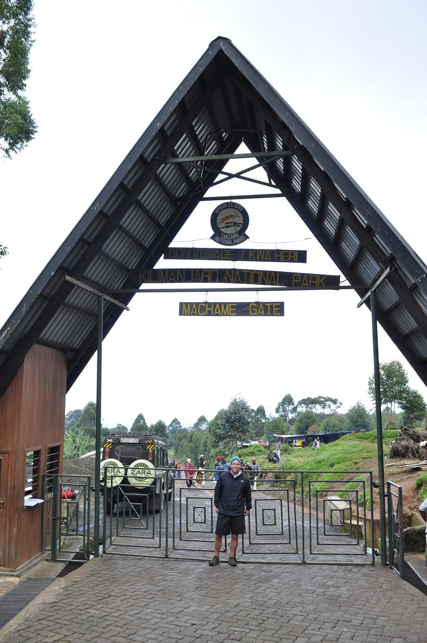
The entrance gate to Machame route and the beginning of the hike.
My tent overlooking the summit of Kili at our campground for the second night, Shira Camp.
My guide Frank posing on day 3 of the hike.  The peak of Kili sits behind him.  Notice that Frank is wearing only a t-shirt and we're at about 14,000 feet.  That's why we call him Iceman. 
Senecios sitting below the peak of Kili on day 4 of the journey.
A map of Kilimanjaro National Park.  The red indicates the Machame route, which was the route I took on a six day, five night trek.  We began at Machame Gate, slept at Machame, Shira, Barranco, Barafu, and Mweka, and finished at Mweka Gate (photo courtesy of alpineascents.com). 

One of the premier sites of Africa is Mt. Kilimanjaro, and one of the premier activities in Africa is hiking Mt. Kili.  The popularity of the hike is due to several reasons: it’s geographical proximity to Arusha and high quality safari drives (Ngorongoro, Massai Mara, Serengeti, etc), the level of difficulty yet accessibility, people can hike this in a relative short period of time (six to ten days), and people can say they’ve hiked the highest mountain in Africa and highest freestanding mountain in the world.  Due to the mystique and reasons listed above, Kilimanjaro attracts thousands of hikers a year and leaves a few dead on its slopes. 
Hiking begins at one of the several trailheads (there are six official routes) in a humid tropical environment before ascending through semi alpine, alpine, and finally through high altitude with snow and no vegetation.   Hikers can expect to sleep at least three days at elevations of 12,500 feet and above, where sleeping can become quite difficult.  (If you want to shell out the money, you can sleep in the crater at the top.  It’s expensive to bring porters to this elevation and VERY cold, but you do get to sleep at about 18,000 feet.) Furthermore, the ascent to the top begins generally at midnight where hikers experience extreme cold and wind for six to seven hours, followed by a 10,000 foot descent to the final camp.  Despite there being no technical climbing required, Kili is a very demanding hike.  Reports listed by Kilimanjaro National Park estimate that 41% of hikers reach Uhuru Peak, the top of Mt. Kilimanjaro. 
In late June I made a six day journey to hike to the top of Kili.  The team consisted of my guide Frank, my cook, three porters, and me.  Due to my exhaustion from trekking across Africa, I wasn’t able to make it to the top.  My guide and I decided to turn around at approximately 18,300 feet (Uhuru Peak’s elevation is 19,341 feet officially), so I never made it to the roof of Africa.  I’ll be honest: it was disappointing.  However, aside from the 1,000 feet I didn’t make of the mountain I had a great trek.  I saw some gorgeous areas and met some great people along the way.  Furthermore, I learned a lot about myself.