Friday, July 13, 2012

Kenyan coast

One of the many corridors in Lamu.
Hanging out on one of the main streets and tourist sections of Lamu.
One of the many beautiful doors in Lamu.  Similar doors are seen in Stone Town, Zanzibar.
Shela Beach, located 5 km from Lamu.
One of the trees that grew around an ancient wall in Gede. 
Kat poses in the mihrab (echo chamber) in one of the mosques in Gede  A mihrab is a section of the mosque where Muslims pray loudly and hear their prayers echo throughout the area
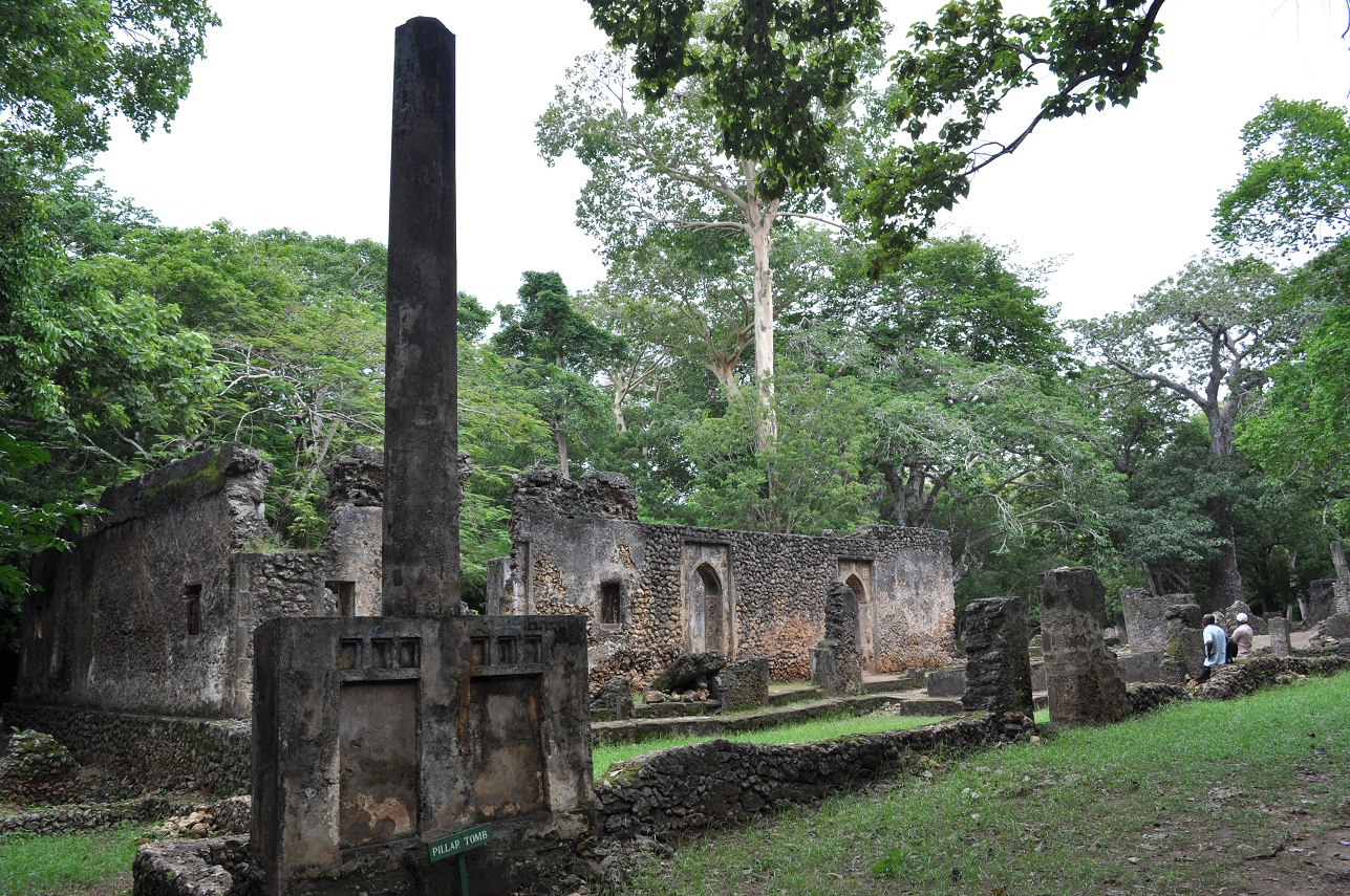
The pillar tomb and Great Mosque of Gede. 
The greater palace area of Gede.  In the foreground is another tree that grew around a palace wall. 

           It shouldn’t come as a surprise that one of Kenya’s major sources of revenue comes from tourism.  Many think of the many safaris (Tsavo, Massai Mara) and Nairobi when discussing tourism in Kenya.  However, the Kenyan coast does a fair share of tourism too.  The beaches and ancient Muslim towns draw tourists every year to the coastal towns and resorts. 
            The 2007-2008 election devastated the tourism in Kenya due to the major violence and fear of civil war.  While those fears were abated and tourism came back, recent issues with Al-Shabaab and Somali refugees have placed major concerns with the Kenya-Somali border and the Kenyan coast.  Terrorist attacks on coastal towns destroyed tourism in Lamu and Pate last year, and recent attacks in Mombasa have reignited concerns about safety on the coast. 
            One of the major tourism sections is the town of Lamu, situated on the northern section of Kenya’s coast.  This old Muslim town is less famous than Zanzibar’s Stone Town, yet Lamu is as beautiful and has just as many winding corridors and fun alcoves to discover.  There are boys riding donkeys through the town and mosques on every corner.  While Lamu may be 100 years past its peak (due to the abolition of slavery, Lamu was once a major slave trading port), it was rediscovered in the past 30 years as a vacation spot.  Shela beach is a popular spot near the town to relax, while Lamu attracts the explorers and adventurers of Kenya.
            Closer to Mombasa is the traditionally Italian and British vacation spot of Malindi.  This beach town is a major commerce center for Kenyans, but Europeans know it for the Italian restaurants and resorts.  A smaller version of Malindi is situated 20 miles south in the beach town of Watamu.  While Watamu may claim tourists for relaxing, it is also next to the famous Gede ruins.
            Gede was once a prosperous town that traded with areas far away as Persia, China, and Portugal.  Due to ivory (and probably slaves), Gede’s trade resulted in a civilization complete with a sultan and several mosques.  There are cemeteries, massive drinking water wells, and communal areas for men and women.  At Gede’s height (estimated between the 12th and 18th centuries), Gede was one of the most prosperous and richest areas on Africa’s Indian Ocean coastline. 
            Gede’s decline is a mystery and has several theories: drawdown or salt water in the wells, disease, attacks from inland, or a lack of continuous resources from the surrounding area.  Whatever the reason is a mystery to the greater mystery of Gede: no one knows much about Gede because there are no historical records or texts of its existence.  There are only conclusions that can be drawn from scientific discovery of the area.
            I spent 10 days on the Kenyan coast this past July.  The Kenyans in this area are very amiable and helpful, some of the best I’ve encountered in Africa.  The only downside to this area is the heat and high level of humidity.  Enjoy the photos. 

Wednesday, July 11, 2012

Mt. Kilimanjaro

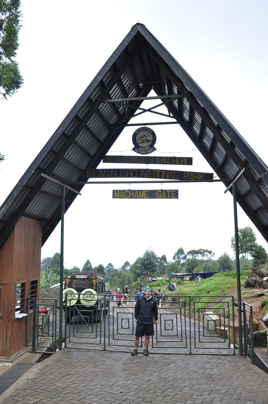
The entrance gate to Machame route and the beginning of the hike.
My tent overlooking the summit of Kili at our campground for the second night, Shira Camp.
My guide Frank posing on day 3 of the hike.  The peak of Kili sits behind him.  Notice that Frank is wearing only a t-shirt and we're at about 14,000 feet.  That's why we call him Iceman. 
Senecios sitting below the peak of Kili on day 4 of the journey.
A map of Kilimanjaro National Park.  The red indicates the Machame route, which was the route I took on a six day, five night trek.  We began at Machame Gate, slept at Machame, Shira, Barranco, Barafu, and Mweka, and finished at Mweka Gate (photo courtesy of alpineascents.com). 

One of the premier sites of Africa is Mt. Kilimanjaro, and one of the premier activities in Africa is hiking Mt. Kili.  The popularity of the hike is due to several reasons: it’s geographical proximity to Arusha and high quality safari drives (Ngorongoro, Massai Mara, Serengeti, etc), the level of difficulty yet accessibility, people can hike this in a relative short period of time (six to ten days), and people can say they’ve hiked the highest mountain in Africa and highest freestanding mountain in the world.  Due to the mystique and reasons listed above, Kilimanjaro attracts thousands of hikers a year and leaves a few dead on its slopes. 
Hiking begins at one of the several trailheads (there are six official routes) in a humid tropical environment before ascending through semi alpine, alpine, and finally through high altitude with snow and no vegetation.   Hikers can expect to sleep at least three days at elevations of 12,500 feet and above, where sleeping can become quite difficult.  (If you want to shell out the money, you can sleep in the crater at the top.  It’s expensive to bring porters to this elevation and VERY cold, but you do get to sleep at about 18,000 feet.) Furthermore, the ascent to the top begins generally at midnight where hikers experience extreme cold and wind for six to seven hours, followed by a 10,000 foot descent to the final camp.  Despite there being no technical climbing required, Kili is a very demanding hike.  Reports listed by Kilimanjaro National Park estimate that 41% of hikers reach Uhuru Peak, the top of Mt. Kilimanjaro. 
In late June I made a six day journey to hike to the top of Kili.  The team consisted of my guide Frank, my cook, three porters, and me.  Due to my exhaustion from trekking across Africa, I wasn’t able to make it to the top.  My guide and I decided to turn around at approximately 18,300 feet (Uhuru Peak’s elevation is 19,341 feet officially), so I never made it to the roof of Africa.  I’ll be honest: it was disappointing.  However, aside from the 1,000 feet I didn’t make of the mountain I had a great trek.  I saw some gorgeous areas and met some great people along the way.  Furthermore, I learned a lot about myself.

Monday, June 18, 2012

Mozambique's northern coast

Chapel of Nossa Senhora de Baluarte, Mozambique Island.  Built in 1522, this church is the oldest European constructed building in the southern hemisphere.
Inside the Chapel of Nossa Senhora de Baluarte, Mozambique Island.
Drinking tea and relaxing on the Mozambique Island coast at sunset. 
A stretch of Wimbi Beach, Pemba, Mozambique.
Looking out at the Ibo Island Hotel at Ibo Island, Quirimbas Archipelago, Mozambique.
Taking a break at Ibo Island Lodge, Quirimbas Archipelago, Mozambique.
A statue wlecoming guests at the entrance of Miti Miwiri, Ibo Island, Quirimbas Archipelago, Mozambique. 

                While the business world is looking to the Mozambique for their massive oil and gas reserves, tourists come here for their famous beaches and dive sites.   From a tourist perspective Mozambique can be separated into two zones: north and south.  In fact, Mozambique wasn’t even connected by a road (the Zambezi River separated the country in two) until 2009.  This has created two subsets of tourism on the coast as well. 
                The southern coast (Maputo to  Sofala) is the most popular section of Mozambique due to ease of access and proximity to South Africa.  During the South African holiday season (December and Easter break), these areas are packed with tourists.  There are stretches of beach that include diving with whales and whale shark.  Furthermore, this area is much better equipped to handle high levels of tourists. 
                The northern coast (Zalala Beach to Quirimbas Archipelago) is more popular for their history, ruins, and archipelago.  Mozambique Island was the first center of this former Portugese colony, Pemba is a center close to Wimbi Beach, and the Quirimbas Archipelago is known for pristine, untouched tropical areas and beaches.  Few tourists come to this area and traveling in this section of Mozambique is extremely difficult. 
                For a challenge and a glimpse into the fourth poorest country in the world, Mozambique is a solid choice.  For whale shark diving and nice beaches, Mozambique is a solid choice.  For working roads, good communications, and comfort; Mozambique is not your choice. 

Malawian people

Children posing at Cape Maclear on Lake Malawi.
The children love to have their picture taken.  Cape Maclear, Lake Malawi.

Children fishing by on the shore.  Cape Maclear, Lake Malawi.


                Malawi is a landlocked country that is famous for catastrophes, famines, and AIDS.  But any savvy African traveler will tell you the real reason Malawi should be famous: their people.      
                While almost all Malawians understand Chichewa, English is widely spoken.  Since most Malawians speak English it is easy to identify their main attribute as some of the friendliest people you will ever encounter.  This is one reason that despite transportation problems (abysmal getting around), high infant mortality rate (8%, there’s only 1 doctor for every 65,000 people), low life expectancy (51 years old), and low income that people call Malawi the “Africa for Beginners”: their friendliness. 
                Their children are some of the most boisterous and engaging African children you will ever meet.  After one week I was thoroughly frustrated at getting around, but loving the people and country at the same time.            

Sunday, June 3, 2012

Victoria Falls

Taking a zipline through the Victoria Falls gorge.
Riding an elephant and going on a safari!
A view of the falls from the Zimbabwe side.
Up close to the falls on the Zimbabwe side inside Mosi-oa-Tunya National Park.
A view of the falls from the Zambia side.
A view of Victoria Falls from the microlight.
Standing at the top of the falls at Mosi-oa-Tunya National Park in Zamiba.

                One of the premier sites of Africa is Victoria Falls.  This falls is a section of the Zambezi River sitting on the border between Zambia and Zimbabwe, and is one of the three major falls in the world (Niagara Falls on the New York/Canada border and Iguaçu Falls on the Brazil/Argentina border are the other two).  While it is not the widest or tallest waterfall in the world, Victoria Falls is the largest fall when taking into consideration height, width, and average flow. 
                Victoria Falls was founded by David Livingstone in 1855 during an expedition to the center of Africa, and named them after the current queen of England, Queen Victoria.  There were rumors of the falls prior to Livingstone’s discovery, and afterwards people refused to believe in the existence of a fall of such magnitude.  On the construction of the Victoria Falls bridge in 1905 (initially constructed to exploit and transport minerals north of the Zambezi), access to the falls became much easier and the tourism era began. 
                Today you can bungee jump, gorge swing, zip line, abseil, micro light fly, take a helicopter, whitewater raft, canoe, and ride elephants in one of the best adrenaline locations in the world.  I was at the falls during the peak flow of the year (mid-May) while low flow is in mid-November and flows at only 4% of peak flow conditions.  Unfortunately, you cannot go to the famous Devils Pool (where you swim at the edge of the falls) nor go whitewater rafting this time of year due to the high water levels.  I ended up zip lining, abseiling, taking a micro light flight, and elephant ride safari during my four days on the Zimbabwe and Zambia sides of the falls. 
Victoria Falls statistics
Height:                                 360 ft
Width:                                 5,604 ft (just over a mile)
Average flow:                     287,606 gallons/second
Peak flow:                            792,461 gallons/second               

Monday, May 21, 2012

Great Zimbabwe

The entrance to the king's complex on the hill.
A view of the great enclosure from the king's complex.  From here the king could see his kingdom and all his wives.
The Zimbabwean flag.  Notice the bird on the left.
The king's court.  Can you see the bird in the rocks?
How about now?  This is the bird represented on the flag.
The faux granary showing the wealth of Great Zimbabwe.  It's now Zimbabwe's greatest icon.
Hanging out on the wall of the great enclosure.

                When you think of monuments to ancient civilizations in Africa, what comes to mind?  The pyramids of Egypt would easily be first, then maybe Timbuktu in Mali, but what about Great Zimbabwe?  It’s a long forgotten ruin that more than deserves recognition for the civilization and ability to teach us about ancient Africa.
                In 1980 Southern Rhodesia changed from a British colony to an independent country.  In search for a new name and symbol, they looked to the ancient civilization in the center of the country.  Zimbabwe means “house of big stones,” and Great Zimbabwe symbolized this with massive stone walls and civilization.  Furthermore, the bird symbolized on the Zimbabwean flag comes from a stone crafted bird found in Great Zimbabwe in addition to stones in the King’s judicial court in the form of the bird.  Despite this deep representation of Zimbabwe, few Zimbabweans ever travel there.
                The greatest era of reign for this ancient civilization was from the 11th to 16th centuries.  Due to seasonal winds and greater abilities to travel exceptional distances, traders from all over the world landed in ports in current Mozambique to trade with Great Zimbabwe.  This impressive feat of trading with sea faring vessels despite their location far from any port is only shown in one other place in Africa (Axum, Ethiopia).  From the coast goods would be brought into Great Zimbabwe, which in turn would be traded for goods to be sent back to the ports.  The results are astounding: pottery, tools, and beads have been found from Portugal, Persia, and China.  These cultures were interested in Great Zimbabwe’s two greatest commodities: gold and ivory.  As a result Great Zimbabwe flourished and became the greatest sub-Sahara African ruins that we have today.
                The ruins are basically divided into two areas: the king’s hill complex (perched high on a hill overlooking the rest of the structures) and the great complex.  Between these two areas there is evidence of education, iron smelting, a court of law, and congregation area to discuss issues with advisors.  In a sign of wealth (a la the Tower of Pisa in Italy), Great Zimbabwe constructed a fake granary which still stands as the premier symbol of Zimbabwe. 
                I took a two hour tour of the ruins with a Zimbabwean guide.  We battled the heat and baboons to explore the grounds, but the effort was worthwhile. 

Wednesday, May 16, 2012

Namib and Kalahari Deserts

The Namib desert outside of Swakopmund, Namibia.
Sandboarding in the Namib Desert, Namibia.
Quad biking is actually really fun out in the desert dunes.  Namib Desert, Namibia.
Catching the sunrise on Dune 45, Sousselvei, Namib-Naukluft Park, Namibia.
Atop the Sousselvei Dunes, Namib-Naukluft Park, Namibia.
One of the many dunes in the Sousselvei, Namibia.
A fisherman piloting a mokoro in the Okavango Delta, Botswana.
Cruising in a mokoro in the Okavango Delta, northern Botswana.


            The desert is a cruel and unforgiving place.  It’s also where a nation, Namibia, sits between two of the largest deserts in the world.  The west coast of Namibia is the sand dune Namib Desert which houses the world famous areas of the Sousselvei and Skeleton Coast.  To the east is the bushier Kalahari Desert.  This arid Kalahari plain extends from northern South Africa to the Congo border, and from Namibia to Botswana. 
            Look on a map of Namibia and you won’t see many settlements.  There is a reason: no water.  Namibia is (along with Mongolia) the least densely populated country on earth.  Coming here from Rwanda was a night-and-day situation.  Here is a land of vast stretches with nobody around.  In fact, on my drive from Swakopmund to Sousselvei (five hours on a gravel road) I came across one building: a gas station with no gas.  Now look at a map of Botswana.  Most of the country (with the exception of the east and south border areas) has very few settlements due to the Kalahari Desert.  It’s no different than looking at a map of Nevada.
            Undoubtedly the most famous part of Botswana is the Okavango Delta.  The largest inland delta discharges all of the Okavango River water into dry salt pans in the middle of the desert (this was the area that Planet Earth filmed their first hour of the series).  As a result Botswana has some of the best wildlife viewing opportunities in the world.  Traveling in a mokoro (carved out wooden boat), you rarely encounter water deeper than a few feet.
            The past two weeks have been a journey of going through these two deserts in search of their best activities and most scenic opportunities.  Enjoy the photos.